In August, Frosty and I took on the Greenville Pinnacle Pursuit Ultra Challenge. The Greenville Pinnacle Pursuit Challenge involves 6 mountain hikes in the Greenville area. Greenville Pinnacle Pursuit Ultra Challenge involves climbing those same 6 hikes, but in a continuous 48 hour time span.
You Can Get Information About the Greenville Pinnacle Pursuit at the Moosehead Lake Region Visitor Center
Frosty and I had completed the Greenville Pinnacle Pursuit Challenge last summer. We wanted to take on the Ultra this summer. With our Appalachian Trail hiking trips and other commitments, we were running out of time to fit it in this summer. We decided to attempt it the day after I ran the Corporal Cole Half Marathon in Norridgewock. After the race, we headed to Greenville, grabbed some pizza from Jamos, and tented at the Moosehead Family Campground.
Starting Point for the Greenville Pinnacle Pursuit
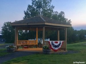
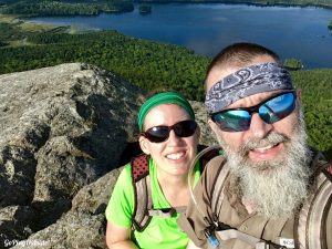
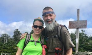
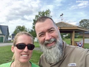
The next morning, we woke up with the sun, packed up the tent, and headed to the gazebo near the Moosehead Marine Museum. This is the official starting and ending location for the Ultra. We took our selfie at the gazebo at 5:32 and headed out.
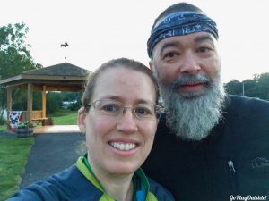
Frosty and Magoo at the Gazebo
The first mountain on our list was Big Moose Mountain. This mountain was formerly called Big Squaw Mountain. It was still a bit dusky as we headed up at 5:55. We have climbed Big Moose in the winter as well as the summer. The trail wasn’t as muddy as our previous summer visit, but there were definitely some muddy spots. This trail looks like it tends to mud up. Some of the muddy spots are easy get around.
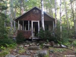
Old Fire Warden’s Cabin on Big Moose Mountain
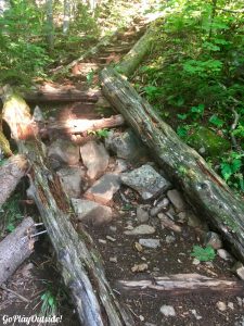
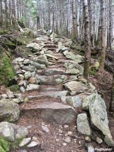
This trail is steep in sections, especially after the old fire warden’s cabin. There is a small, scenic gorge and brook near the cabin. Not too long after that the trail has a bunch of stone steps. Ugh. Most steps are just not space right for my short legs.
Trail for Big Moose Mountain
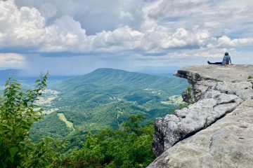
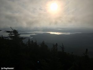
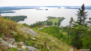
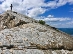
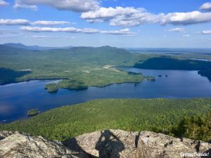
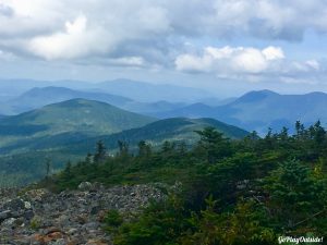
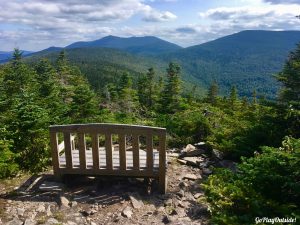
The views at the summit are incredible though, definitely worth the effort. Spectacular views in every direction. Even on this day when the valleys were blanketed by clouds. We were at the summit at 7:07. There are remnants of the old fire tower at the summit and if you continue on there is a helicopter pad that makes a great place to have a snack while enjoying the views.
View from the Summit of Big Moose Mountain
On the descent, we met the only other hikers that we saw on Big Moose. A young couple was heading up.We got to the Big Moose parking lot at 8:17.
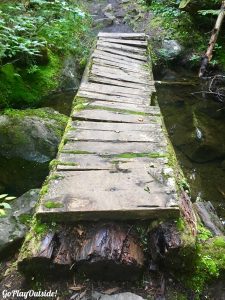
Bridge on the Trail of Big Moose Mountain
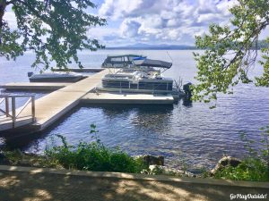
We decided to climb Mount Kineo next. The logistics of climbing Kineo were hanging over my head. You take a boat from the Rockwood Public Landing across a section of Moosehead Lake to the Mount Kineo area. Timing was the issue. We didn’t want to miss the boat over or wait too long for the return boat back. The boat leaves the public landing on the hour and departs Kineo quarter to the hour.
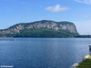
View of Mount Kineo from the Rockwood Public Landing
Since the boat schedule was out of my control, it concerned me. I didn’t want the boat timing to delay our plans for the day. I knew I would feel better after we returned from Mount Kineo because everything else would be in our control, fail or succeed purely based on our own physical limitations.
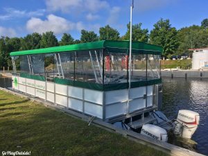
The New Larger Shuttle Boat to Mount Kineo Was Docked for Repairs on the Day We Visited
We made it to the Public Landing in time for the 9:00 shuttle to Mount Kineo. The costs is $12 per person, five and older. Dogs and children under 5 are free. The shuttle only takes cash. The shuttle takes about 10 minutes to cross from point to point. The shuttle was full and then some. Many golfers were heading over to the Mt. Kineo Golf Course. Luckily, we arrived before a large group, so we made it on the boat. The shuttle operator was going to make a second trip to get the rest of the people. You can’t rely on that though.
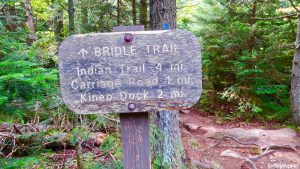
Sign for the Bridle Path on Mount Kineo
Our goal was to climb Kineo and be back at the boat landing in time for the 10:45 trip back to Rockwood. At 9:10, Frosty and I started our second hike of the day. We ran along the shore path to get to the trailhead. We decided to go up the Indian trail. It is steeper, a bit more difficult, and a little shorter than the Bridle trail. These are the two most commonly used trails up Mount Kineo. The Indian trail has the best views by far. That is why we chose to go up the Indian trail.
View from the Indian Trail on Mount Kineo
We reached the former fire tower at the summit at 9:49. The view from the tower is incredible! There is a 365° view of mountains and lakes. We headed down the Bridle trail. This trail was originally the fire warden’s trail. Frosty and I arrived at the dock at 10:29, in plenty of time to make the 10:45 shuttle.
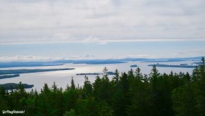
View from the Tower at the Summit of Mount Kineo
I felt much better about the rest of the day after arriving back in Rockwood. We were on our own time frame now. Frosty and I headed to do the Eagle Rock climb next. Eagle Rock is an exposed promontory at the end of Big Moose Mountain’s northwest ridge.
Shuttle dock near Mount Kineo. The Kineo Shuttle Has the Green Awning
We set off on hike our third hike of the day at 11:33. Last summer we climbed the new, longer trail up to Eagle Rock. This time we took the old trail. I’m not sure if this trail is formally maintained any more. It is shorter and steeper. It is also more fun and interesting. There were a few trees down across the trail that we maneuvered around. The trail also had a ladder at one point. The trail was well marked.
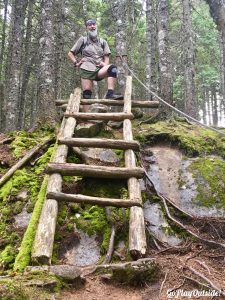
Frosty at the Ladder and Rope on the Eagle Rock Trail
We reached the top of Eagle Rock at 12:44. Eagle Rock is a very cool place with an awesome view. The precipice of Eagle Rock is very steep. This is a great place to take a break and have a snack, which we did. There are spectacular views in every direction. While we were sitting another hiking party arrived. We had a nice talk with them for about 20 minutes. They were from Peabody, Massachusetts. They had a summer house near the Kineo Golf Course. They have hiked up here many times. They preferred the old trail as well.
Frosty atop Eagle Rock
Now, we had a decision to make. Do we try to hike Borestone Mountain today or tomorrow? We decided to go for it. It would have been nice to hike it right then, but we had to travel to to get there. It seemed like it took forever.
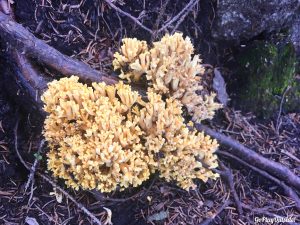
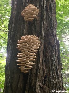
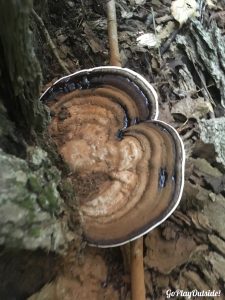
Fungus
We started our fourth climb of the day at 3:20. Visitors can hike up the base trail or walk on the access road. We went up the base trail. It is much more scenic and interesting. The base trail does meet up with the access road before reaching the outhouse and visitor center for the Borestone Mountain Audubon Sanctuary. The visitor center was closed when we arrived.
More Fungus
The visitor center is roughly halfway between the trailhead parking and the summit. The area near the visitors center is scenic itself. The tiny cabin that serves as the visitor center is on the edge of Sunrise Pond. There are a couple picnic tables and a view of rocks of the West Peak of Borestone across the pond.
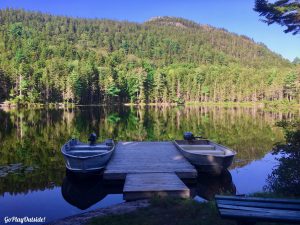
View of Sunrise Pond and Borestone Mountain
From the visitor center, we continued upward on the summit trail. I really began dragging at this point. I was questioning my decision to squeeze Borestone in today. This trail is steep in places and has over 100 stone steps. My legs were certainly feeling the half marathon that I ran yesterday.
View of Lake Onawa from the East Summit of Borestone Mountain
There are a couple of steel railings and foot rungs to help hikers negotiate the rock ledges near the West Peak of Borestone. After reaching the West Peak, we continued onto the East Peak. We arrived there at 4:55. There are spectacular views from both peaks of Borestone. The East Peak has a sign identifying the landmarks visible in the area. Usually, we have a snack here and enjoy the view. Not today, I was ready to finish our hike and be done for the day.
Frosty and Magoo East Summit of Borestone Mountain
We decided to take the access road back to the parking lot. I was beat. We arrived at the vehicle at 6:22. Our original plan was to camp at the Logan Brook Shelter on White Cap Mountain. I was too tired and it was getting too late for that. We went back to Moosehead Family Campground. I set up the while Frosty grabbed us some food in Greenville. He brought it back to the tent site. We devoured the food and crashed for the night.
Shelf Fungus
Our daily stats for the four hikes combined based on our Garmin data was 14.5 miles of hiking and 5,096 feet of elevation gain.
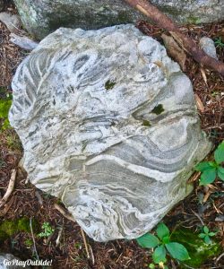
Cool Rock on the Trail
We slept in the next morning. We only had two mountains to do, so we decided to take it slow. We packed up the tent and headed for White Cap Mountain. The last time we hiked White Cap the gate was open, and we were able to drive to the point where the Appalachian Trail crosses the road. This morning the gate was locked, so we started the day with a quarter mile walk to the trailhead. We left the vehicle at 8:39.
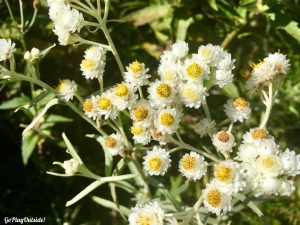
Pearly Everlasting On the Trail of White Cap Mountain
We started up the trail headed toward the Logan Brook Shelter. The beginning of this trail is steep and has one of my favorite non-summit views. There is one steep, rocky section adjacent to a large rock. On the rock, is a 3-D life-size dalmatian dog.
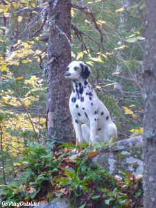
Dalmatian Overlooking the White Cap Mountain Trail
I don’t know the story behind the dog, but would love to. It tickles my funny bone so much to see this dog sculpture in the middle of the woods. It reminds me of the old Wheel of Fortune, where winners picked prizes from staged room. There always seemed to be a dalmatian dog as one of the prizes. I’m not sure why. A few contestants actually picked the dalmatian, probably to specifically show off that they had been on Wheel of Fortune.
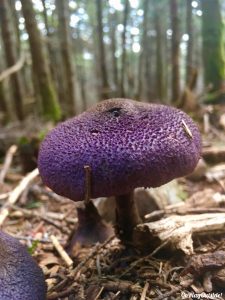
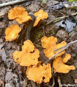
Mushroom (Cortinarius Violaceus) on White Cap Mountain
After the initial steep beginning, the trail flattens out for awhile before arriving at the shelter. As we neared the Logan Brook Shelter, we ran into Rocket, a thru hiker on the AT. We were so surprised. Frosty and I had met her briefly on the summit of Bear Mountain in Connecticut. She was a very impressive, strong hiker. We stopped at the shelter to have a snack and read the register.
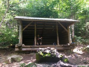
Frosty Reading the Register at the Logan Brook Shelter White Cap Mountain
After the shelter, the trail heads uphill again. There was a fair amount of moose scat along the trail, but we didn’t spot any moose while hiking. This trail also has stairs. Unlike the stairs on Big Moose or Borestone though, these stairs were comfortable for hiking. I think because the rise was smaller.
White Cap Mountain Trail
Before the summit, we came to an area of tuckamore, in Newfie speak this term is for trees that have been stunted and bent by extreme wind. I learned of this term after summering in Newfoundland. I love it and have adopted it as well as a German term for the same phenomena, krumholtz.
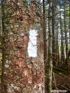
Appalachian Trail Blaze on White Cap Mountain
After the tuckamore was an open rocky area with low vegetation. This area had both cranberries and blueberries growing. Both were ripe.
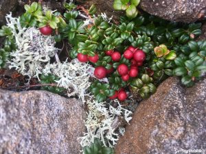
Cranberries on White Cap Mountain
We continued onto the summit arriving at 10:51. Frosty and I stopped to enjoy the view and have another snack. While there we met a fellow hiker, who we talked to for 45 minutes. He was from out of state. He travels around the country hiking to areas that have abandoned railroads. That isn’t why he was on White Cap though. We had a lot of fun talking to him about his travels and sharing ours.
Frosty and Magoo at the Summit of White Cap Mountain
We finished the White Cap hike at 1:16. Since the White Cap hike was on the AT and the time of year was right, we saw a variety of thru hikers, mostly NoBos (hikers traveling the AT northbound). It was cool seeing thru hikers, although Rocket was the only familiar one.
View from the Summit of White Cap Mountain
Frosty and I headed to our last hike (number 6) of the Pinnacle Pursuit. We knew finishing the Ultra challenge was going to happen, so we took our time. Our last hike would be Number 4 Mountain. We started out at 2:04. The beginning section travels on some bog boards through the woods.
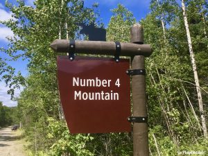
Sign for Number Four Mountain
Number 4 has some steep sections, as did all the Pinnacle hikes, but they are short hikes. Number 4 does have a bunch of switchbacks, not all that common around these parts. They do make the trail longer, but I like them. Maybe that’s the result of age and ability.
Shelf Fungus
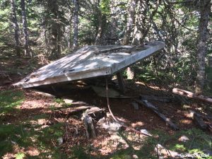
We reached the summit at 3:15. There is an old fire tower without a top at the summit. Remnants of the fire tower cabin can be found nearby on the ground. You can climb up the old ladder a bit for a view, but it is a bit of a challenge for those less athletically inclined. We didn’t climb up this time. We have in the past. Frosty made it up higher than I did. My fear of falling kicked in.
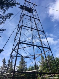
Old Fire Tower Number 4 Mountain
If you want a good view without the circus acrobatics of climbing the ladder, hikers can just continue past the fire tower a short distance. You come out in a clearing. There is even a bench to sit on! We went down to the bench for a snack with a view. The trail continues on past this point to Baker Mountain. This trail continuation is fairly new.
Bench atop Number 4 Mountain
Frosty and I turned around and headed back to the vehicle. The Number 4 hike seemed longer than I remembered it from last summer. I’m sure part of that was just anticipation of being almost done the hiking portion of the challenge. When we got back to the vehicle, we cleaned up as best we could.
Old Roof from the Fire Tower
After the six hikes have been completed, Ultra participants have to go back to the gazebo in Greenville where the challenges started. The drive seemed long because we were hungry! We reached the gazebo at 5:13. We did it! We completed the Ultra Challenge! Our stats for day 2 according to my Garmin were: 10.5 miles and 3,541 feet of elevation gain.
Frosty and Magoo Finishing Back at the Gazebo
Before leaving Greenville, we needed to eat. We headed to the Stress Free Moose Pub & Cafe. It was pretty busy, but we didn’t have to wait for a table. We devoured a delicious meal then headed home for some rest!